

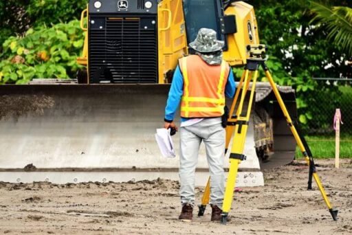
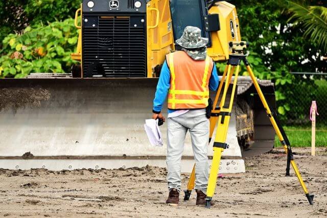

Land surveying rarely gets the spotlight it deserves, yet for businesses operating in New South Wales’ Hunter Region, reliable surveyors can make or break a development. Whether you are planning major infrastructure works or a straightforward property subdivision, expert land surveying underpins almost every significant land-related decision.
Working with a land surveying team that understands local council requirements and regional conditions helps reduce the risk of costly boundary disputes, compliance issues, and project delays. In a growing market like the Hunter, accurate spatial data from the outset is more than a legal requirement. It forms the foundation of a successful and profitable project.
The Foundation of Smart Property Development
Before construction begins, accurate survey data must be collected and interpreted. This information shapes everything from site design to regulatory compliance. Businesses that overlook this step, or engage inexperienced surveyors, often encounter avoidable delays and legal complications later in the project.
The Hunter Region is one of regional Australia’s most active property markets. With continued population growth across Newcastle and surrounding areas, demand for residential, commercial, and industrial development remains strong. Businesses need surveyors who understand both the physical characteristics of the region and the planning requirements of its local councils.
For more than 50 years, the team at de Witt Consulting has delivered high-quality land surveying services across Newcastle and the Hunter Region. That depth of local experience gives clients a significant advantage when navigating complex development approvals and site-specific challenges.
What Land Surveying Actually Covers
Many business owners assume surveying is simply about measuring property boundaries. In reality, it encompasses a broad range of technical services that support every stage of the development lifecycle.
Cadastral Surveying
Cadastral surveys establish legal property boundaries. They are essential for resolving boundary disputes, identifying property limits, and supporting land subdivisions. Before any transaction or development proceeds, these surveys must be completed accurately.
Detail and Contour Surveys
Detail and contour surveys document a site’s topography, vegetation, buildings, drainage, and other physical features. Architects, planners, and engineers rely on this information to design projects that suit the site’s conditions. Inaccurate survey data can lead to significant redesign costs later in the project.
Construction and Engineering Surveys
During construction, surveyors set out building positions and monitor structures as work progresses. This helps ensure construction aligns with approved plans, engineering specifications, and council requirements. Ongoing surveying also supports quality assurance throughout the build.
Subdivision and Strata Planning
For developers creating new lots or strata schemes, surveying is a legal requirement. Surveyors work closely with local councils and relevant authorities to ensure new titles are prepared accurately and efficiently.
Why Local Knowledge Matters in the Hunter Region
The Hunter Region presents a unique combination of geographic and regulatory challenges. From Newcastle’s coastline to inland valleys and ridgelines, the landscape varies considerably. Local surveyors understand not only these physical conditions but also how planning requirements differ across councils throughout the region.
A surveyor unfamiliar with local planning instruments may overlook important requirements, resulting in unnecessary project delays. By contrast, experienced regional surveyors have spent years working alongside planning departments and have a clear understanding of what individual councils expect during the approval process.
While the NSW Department of Planning, Housing and Infrastructure establishes the statewide planning framework, applying those requirements efficiently requires both technical expertise and local knowledge. That combination is difficult for firms without regional experience to replicate.
The Business Case for Professional Surveying
Investing in professional surveying is more than meeting regulatory requirements. It is a practical business decision that reduces risk and improves project outcomes from the very beginning.
Starting with accurate survey data helps prevent costly design and construction errors. Businesses relying on outdated or incomplete information are more likely to encounter unexpected site conditions that require expensive remediation and project redesign.
Time savings are equally important. When accurate survey information is available from the beginning, the council approval process is often more efficient. Providing planners and certifiers with reliable information from the outset reduces the likelihood of requests for amendments or additional documentation.
If you intend to sell or lease a completed development, current surveys also provide greater confidence for prospective buyers and tenants by clearly defining the property’s boundaries and physical characteristics.
As Geoscience Australia notes, precise spatial data supports better planning and decision-making across government, industry, and infrastructure projects. Professional surveying should therefore be viewed as a valuable business asset rather than simply another compliance requirement.
Choosing the Right Surveying Partner
Choosing the right surveying firm deserves careful consideration. Look for a partner with proven regional experience, a strong track record across multiple surveying disciplines, and the technical capability to manage complex projects.
It is also worth asking about the firm’s technology. Modern land surveying relies on high-precision GPS, advanced field data collection systems, drone technology where appropriate, and sophisticated digital drafting software. Firms that continue investing in modern equipment typically deliver more efficient and accurate outcomes.
Clear communication is equally important throughout the project. A reliable surveying partner should explain findings in straightforward terms, keep you informed as work progresses, and communicate any unexpected issues before they become larger problems.
As the Australian Institute of Mine Surveyors highlights, professional standards and ongoing development distinguish leading surveying professionals. Businesses benefit most by engaging a team committed to maintaining those high standards.
Ultimately, Hunter Region businesses can approach development with greater confidence by partnering with experienced local surveyors who understand both the technical requirements of the profession and the realities of working within the region.
The Local Advantage
In the Hunter’s fast-moving property market, expert land surveying is more than a legal requirement. It is a practical way to reduce risk, improve decision-making, and keep projects moving efficiently.
Partnering with the team at de Witt Consulting provides access to local expertise, regional knowledge, and decades of surveying experience. Investing in accurate surveying from the outset helps create a stronger foundation for every stage of your project.


